Mountains of the Moon, January 1978

On the second of September my dad sent me an email with the subject line "Zaire." This is the whole of it: "Not sure if the file is attached. This was done by Dave Fredrick about our hiking trip up the 'Mountains of the Moon' in Zaire!!" That is two sentences and two exclamation points, and it brought back six years of my childhood.
We lived in Zaire from 1973 to 1979, while my dad was an engineer at the Goodyear plant in Kinshasa. Goodyear was his identity. He trusted the company and the company was good to him. I was small, but what I remember of Zaire is that it was so earthy, so real. Ali fought Foreman in Kinshasa while we were there, every major power was meddling in the place, and for a while I thought maybe my parents were secret agents. The story my dad told my brother and me most often about those years was how different everything was. The way he put it, it was like an alien you were getting the chance to coexist with.
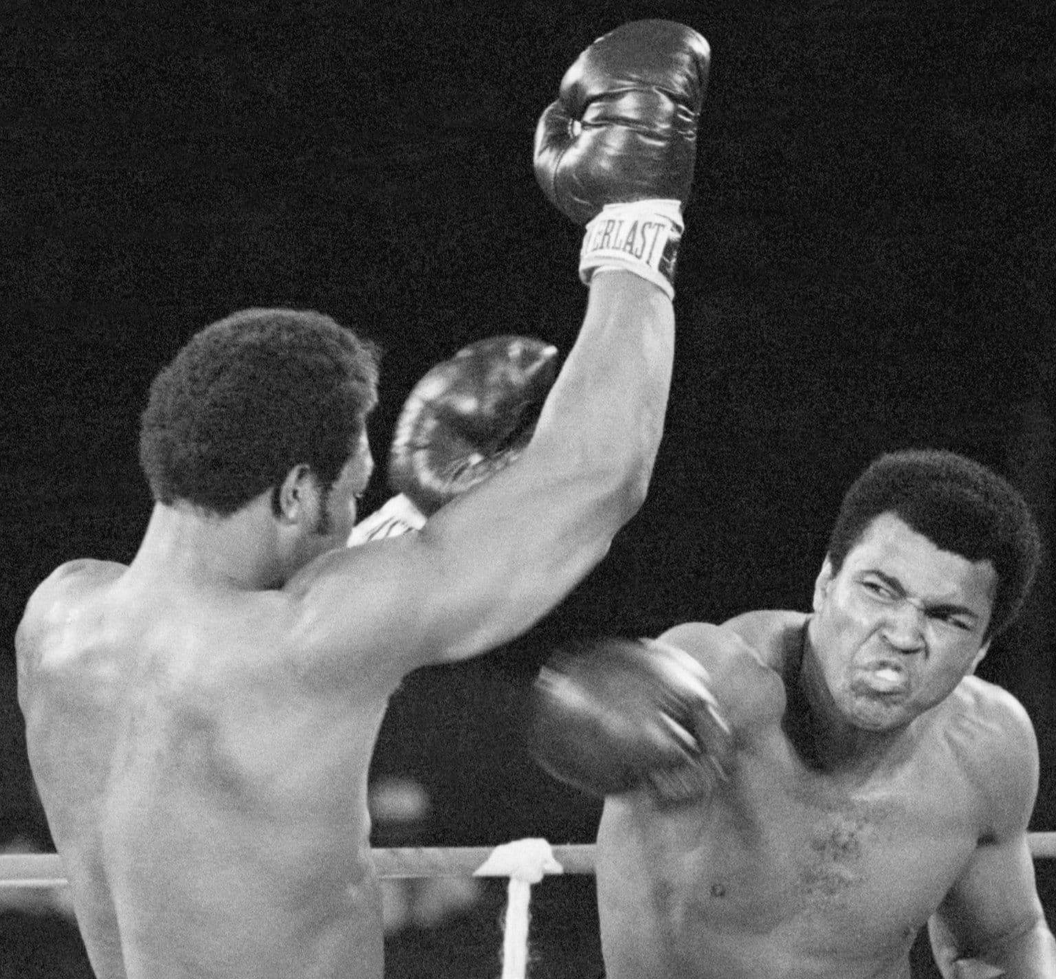
Ali and Foreman, Kinshasa, 30 October 1974. UPI wire photo. Photo: United Press International, Public domain, via Wikimedia Commons.
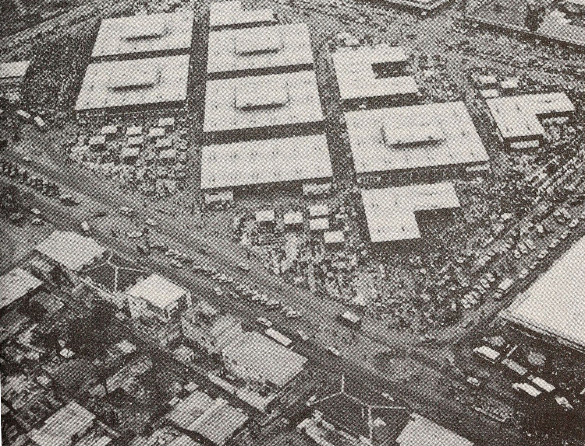
The central market, Kinshasa, in the 1970s, from the Zaire National Tourism Office. Photo: Zaire National Tourism Office, Public domain, via Wikimedia Commons.
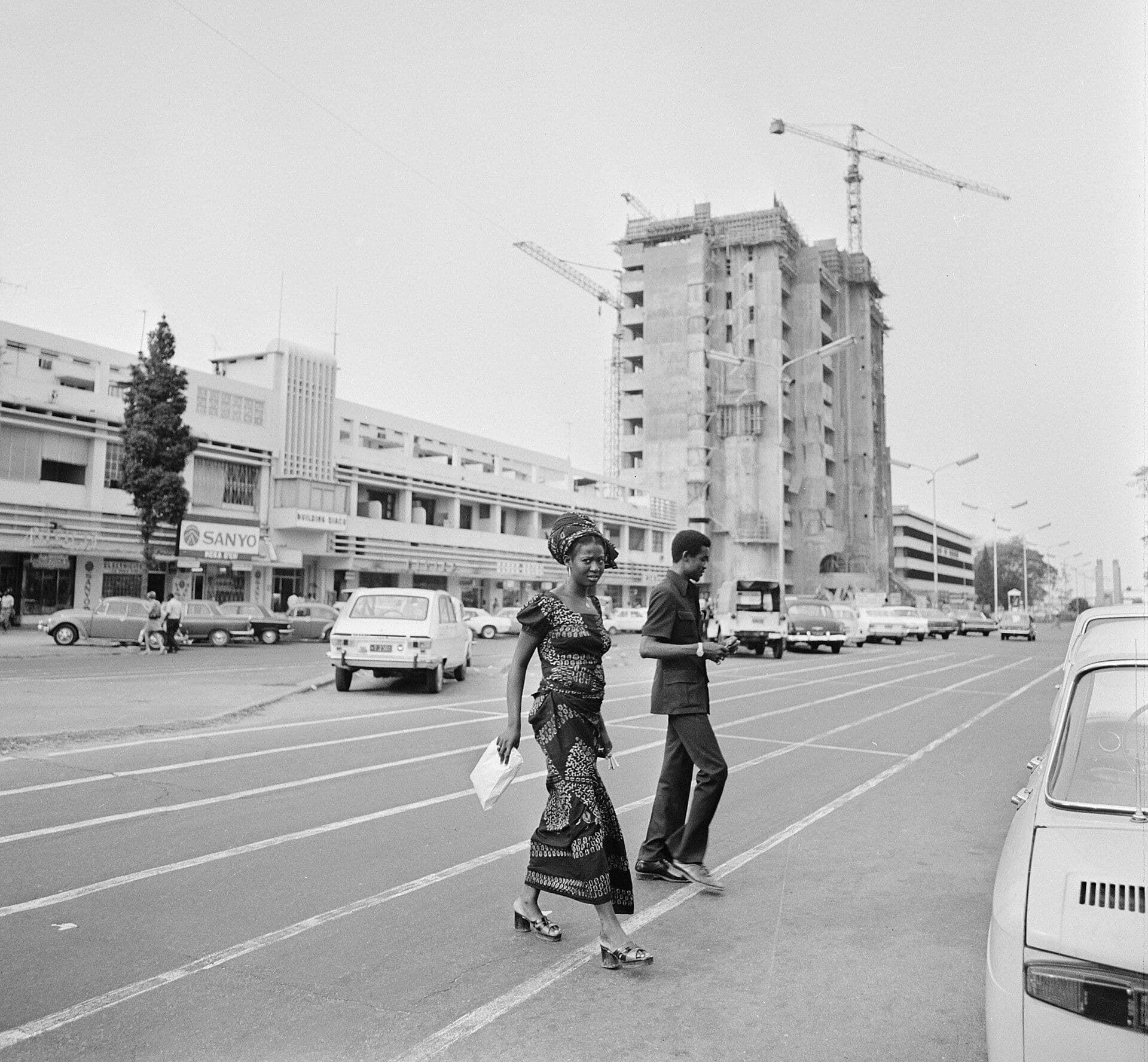
Downtown Kinshasa, October 1973. Photo: Rob Mieremet / Anefo, CC0, via Wikimedia Commons.
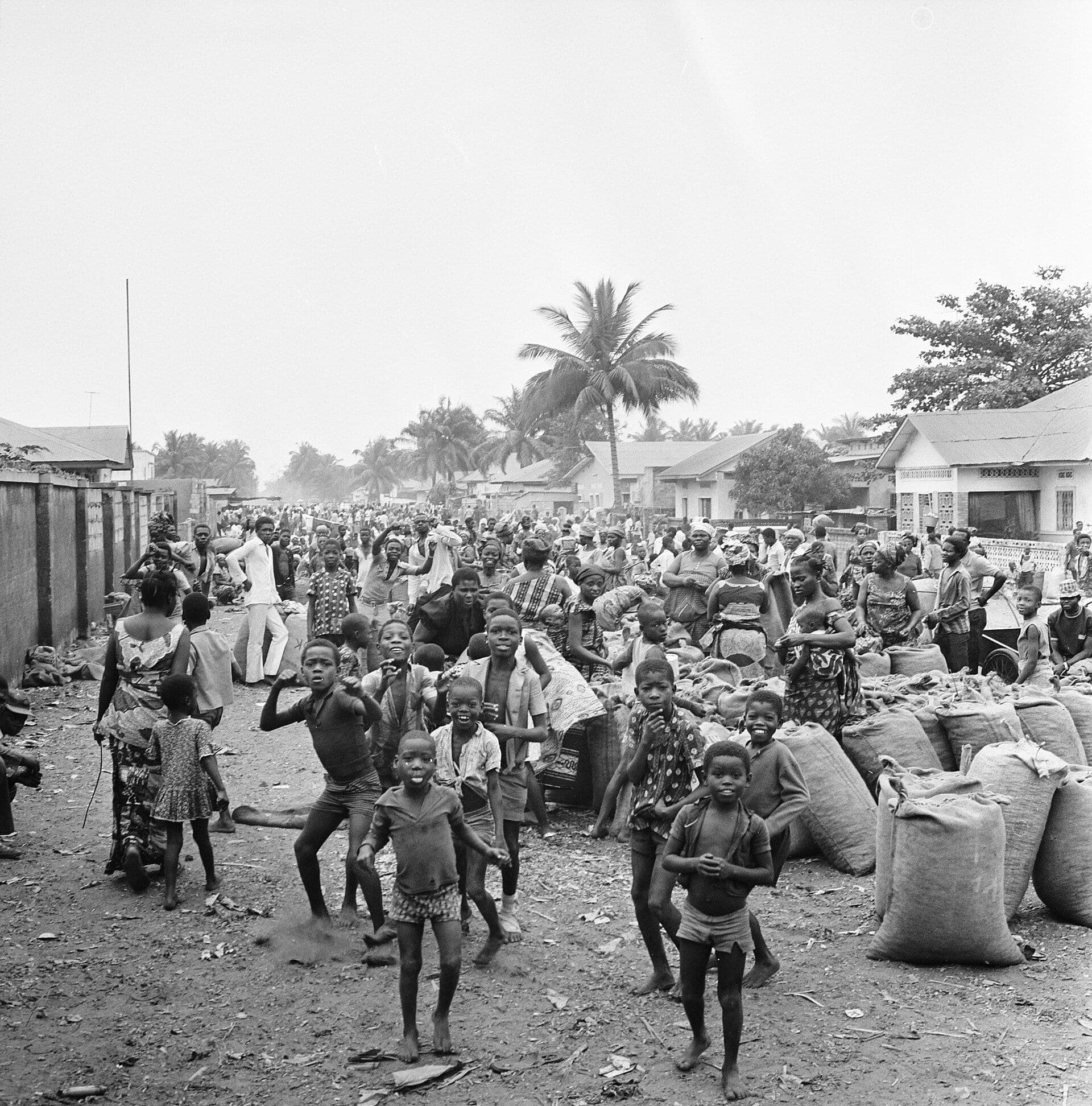
A Kinshasa street, October 1973. We were there within a few years of this. Photo: Rob Mieremet / Anefo, CC0, via Wikimedia Commons.
I knew Dave, though I was very young. In January 1978 he and my dad went with Jeff Smith, Bob and Siriphong Ressiguie and Fred Lasor from Kinshasa to the Ruwenzori, the Mountains of the Moon, on the border with Uganda, eight days out and back. Dave's account is full of how different everything was, from the matabiche at the airport to the spirit houses on the trail to the two beds from the last rest house that were "last seen on the backs of two Ugandans heading across the border."
My dad was the third to sign on, in November 1976. On the fourth day, climbing up and over roots, he was the one who said, "These roots ain't made for walking." When they landed back in Kinshasa, he and Jeff had arranged "one of Goodyear's outrageous fula-fula buses" to take everybody home. And in Dave's advice at the end, the best thing for the feet is "a pair of Nike waffle-type running shoes, as attested by Ralph Cahalane."
My dad called it our hiking trip. Hiking… mildly understated, like him. Dave's account of it is below, exactly as he typed it, typos and all.
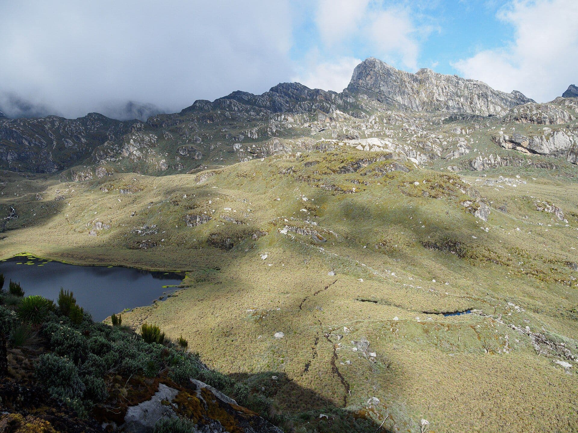
A lake below the moraine in the Rwenzori. Not my dad's photo; his are coming. From the Kiondo hut they sat 'on an outcropping over a 300 meter drop down across a valley, with the step lakes, Black and Green, joined by a waterfall.' Photo: Rafał Kozubek, CC BY-SA 4.0, via Wikimedia Commons.
Trekking the Mountains of the Moon
by David Fredrick
Our quest began at Hank Boldrick’s home in Kinshasa, Zaire, in January 0f 1976. He had gone to the province of Kivu, and ascended the Nyiragongo volcano, the highest in the chain of active volcanoes in Zaire and Rwanda. His guide told Hank, that on a clear day, you could see the fabled Mountains of the Moon. My wife Merry and I and 15 like-minded Americans made the trip to the Nyiragongo summit in July, 1976, and also visited the Virungu Game Park and the Kuhegi Bieza gorilla sanctuary. We did not then see the Mountains of the Moon, but we learned more about these Ruwenzori mountains at the end of the 900,000 hectares national park on the border of Zaire and Uganda. On this first trip to Kivu province, Jeff Smith and I decided that our quest in Zaire would be to trek these strange mountains with glaciers on the equator. Our first problem was to find four other hikers. We became three in November 1976, with Ralph Cahalane’s decision to go. We began ordering provisions, anoraks, backpacks, clothing, etc. and to make tentative air and ground arrangements. We also began conditioning for the hike, which was estimated to be three days up and two days down. For the first time in my life, in April, 1977, I ran a full mile with no break and was soon up to two to four miles per day, five days a week. By August, 1977, all the gear and provisions had arrived and most importantly, three other hikers had signed on, Bob and Siriphong Ressiguie and Fred Lasor. We booked flights from Kinshasa to Goma and return, and reserved a VW minivan from the AMIZA tour agency. I wrote to Marcel Dony, MIZA’s Goma manager, and told him we would be there in early January,1978,
On January 4, we met in downtown Kinshasa, loaded the gear into a Blazer and drove to N’Djili airport. We were met by an AMIZA agent, who guided us though the usual chaos and helped us to evade the “matabiche” or bribery required to do anything there. We flew an international flight to Burundi and then transferred to a Fokkers F-27 to go from Burundi to Bukavu to Goma, a regular palm wine run! We watched our packs get ransacked on the Bujumburi tarmac, as we sat on a balcony drinking warm liters of Primus beer. They only took the candies.
We arrived on schedule at Goma, and were met by our AMIZA driver and guide, who spoke French, Swahili and Lingala. He took us to Marcel Dony, with whom we talked through the trip for about 20 minutes and then we left for the mountains. At the edge of Goma, we saw the end of the 12-kilometer lava flow which had streamed out of Nyiragongo in December, 1976, just five months after our ascent in July. For 25 kilometers, we saw total devastation, except for small islands of vegetation, and one bizarre scene, a village sorcerer’s house was the only dwelling in the area spared. Imagine his power, and that of his sons and his sons’ sons.
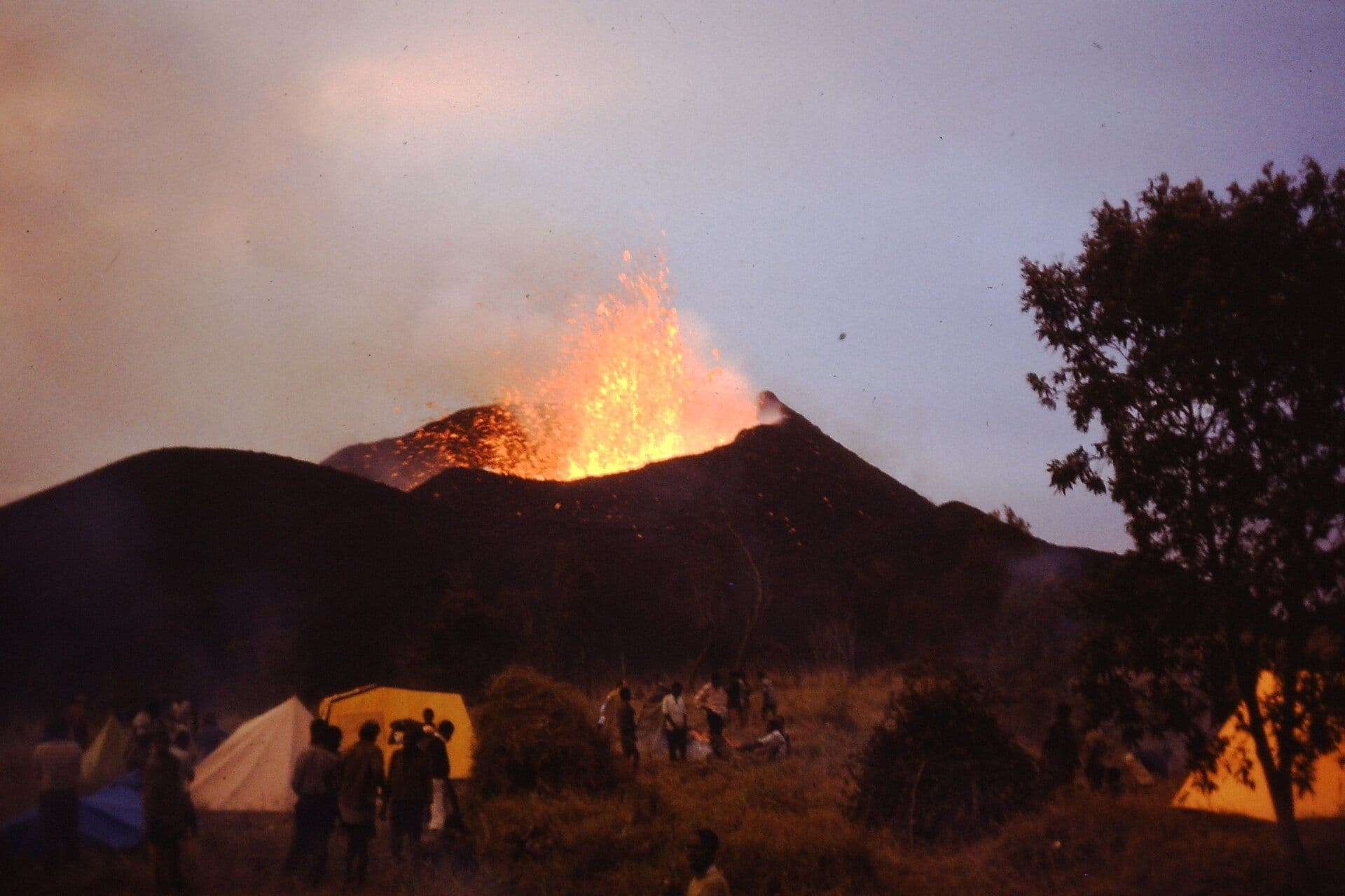
A new cone erupting on the flank of Nyamuragira outside Goma, 8 January 1977. A year later they drove past the fresh lava from its neighbour Nyiragongo on the way to the mountains. Photo: Bryan Pready, CC BY-SA 4.0, via Wikimedia Commons.
After five hours of driving, we arrived at the center of the Virunga game park, and overnighted at the lodge. On day two of the trip, we drive about 9 hours, crossing the equator, from the lodge to the Mutsora base camp of the Ruwenzoris. The ride wove along ridges at about 1500 meters elevation, and on the left was the rim of the Zaire river basin, and on our right were the volcanoes, mountains and great lakes formed by Africa’s shifting tectonic plates. Just outside of Musora, we stopped near a plantation of papaya for processing papayine extract for meat tenderizers and beer stabilizers in America, and bought fresh fruits, vegetables, bread and a couple cases of warm Primus beer.
Arriving at the Mutsora camp at about 5:00 p.m., we could see parts of the foothills, and initial slopes of the mountains through heavy cloud cover. Jeff volunteered to organize the bearers and guide for the trip and spent the next three hours higgling less about the price and more about the starting time. He engaged eight porters to leave at 8:00 a.m. the next day. Meanwhile, we had gotten the hiking and camera permits. Our guide spoke English and was a native of Uganda.
We settled down to a dinner cooked by Fred Lasor and enjoyed our beer chilled by the glacier-fed stream running next to our bush motel. By 10:30, we were sleeping.
On the third day o the trip, we were up with the sun, and were greeted by fleeting full views of the Ruwenzoris. We were overwhelmed by the rapid rise of the foothills and mountains. We set out at 8:30 a.m., beginning from the village of Mutwanga, after crossing a mountain stream. We stopped to buy some green arabica coffee beans, to try roasting and brewing on the trip. The first three hours of the trek were through sparsely settled agricultural lands, where each home had its bougainvillea, banana orchard, mats with coffee beans spread out to dry in the sun and vegetable garden. The trail wound up foothills. We rounded a bend after about an hour and a half, and there were two stone houses. Jeff turned and said, “We’re really making some time, being at the first rest house already.” Our guide popped that balloon, telling us that this was his home, and that he had hiked down that morning to meet us, and that we had about 6 hours of hiking to go to the first cabin. We now began to move through heavy rain forest. The canopy of slender, bushy-topped trees sheltering palm and banana trees, with a heavy undergrowth of ferns and flowers. The trail was clear and about one meter wide. Through this rich rain forest, we had seen no gorillas, though it is an ideal environment. Their absence is one of the mysteries here.
Topping a long and steep incline in the evening, we came to the Kalonge guesthouse, at an elevation of 2138 meters. Fred and Siriphong began preparing dinner. I set out to prepare roasted coffee beans, and three hours later, learned why the conglomerates have a near monopoly on this art. I was not asked to repeat the effort. We found that the down sleeping bags were too hot for much of the trip.
By 8:00 am the fourth morning of our trip, our spirits sank as we lost 400 meters of elevation we had painfully gained the day before. Then we made a fairly long and steady upward hike, finishing with a 60-degree incline for about 1500 meters. At the bench where the slope paused, we saw a complex of spirit houses, the first that any of us had seen in our travels in Zaire. The porters were making offerings of food and we were told that our voyage would benefit if we let food or money for the rain, winds, snow and sun spirits. Here we also found that the word, “Ruwenzori” is Swahili for “rainmaker”. These mountains form the climate and the watershed for much of Zaire’s network of rivers, which contain 14% of the world’s hydro-electric power generation potential.
After an hour of rest, we set out and soon were among the trees colonized by trailing moss. Orchids and other flowers were laced into the mossy trees and lichen-covered ground. The only sound was our huffing and puffing as we climbed up and over roots and limbs. As Ralph said, “These roots ain’t made for walking.” Up to this time, we had not had a full, unclouded view of the range. As evening came, we arrived at the Manungu rest house, at 3,310 meters and the clouds began to sweep up the hillsides and mountains, and the sky cleared above the mountains and we had our first look at this rugged range, with its glaciers, waterfalls and contrasts of black, white and grey. Almost immediately, clouds were super-cooled and came racing back down around us. The temperature change was shocking and we broke out our parkas. This shift kept on for two hours in the evening. Bob and I cooked the meal and everyone was in the sack soon after dark.
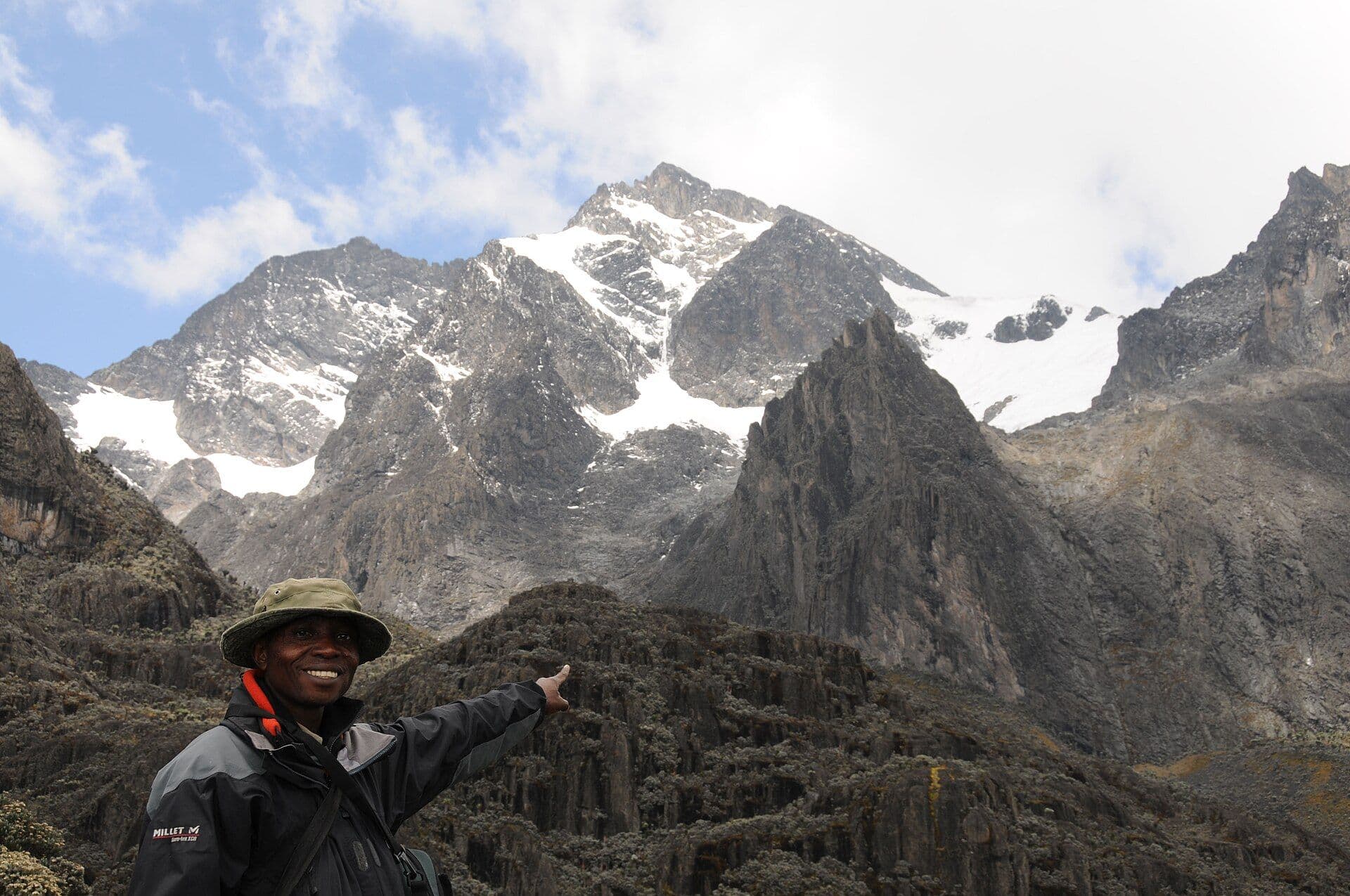
The Ruwenzori from the Congo side, inside Virunga National Park, the side they went up in 1978. Photo: Cai Tjeenk Willink, CC BY-SA 3.0, via Wikimedia Commons.
The fifth day of the trip, we woke with hope that the worst of the ascension was over, and that we were out of the roots. However, the next three hours were the worst of the trip, as we ascended a 60-degree mountain side totally overgrown with roots that grabbed your limbs, tripped your feet and poked you everywhere. We pulled ourselves up foot-by-foot.
At about 3,000 meters, the path levelled and the environment abruptly changed again. We were in a semi-arid section marked by large lobelia and dwarf trees. The trail followed a back ridge, out around a semi-circle and there suddenly laid out before and below us were the range, the lakes and the waterfalls. It was 3:30 in the afternoon and the air was as clear as on an autumn day. We sat along the ridge for an hour and took in this sight so seldom seen. Our guide told us that no more than 500 people come to the Mountains of the Moon each year. By 5:30 pm, we arrived at the third house, Kiondo, at 4,200 meters.
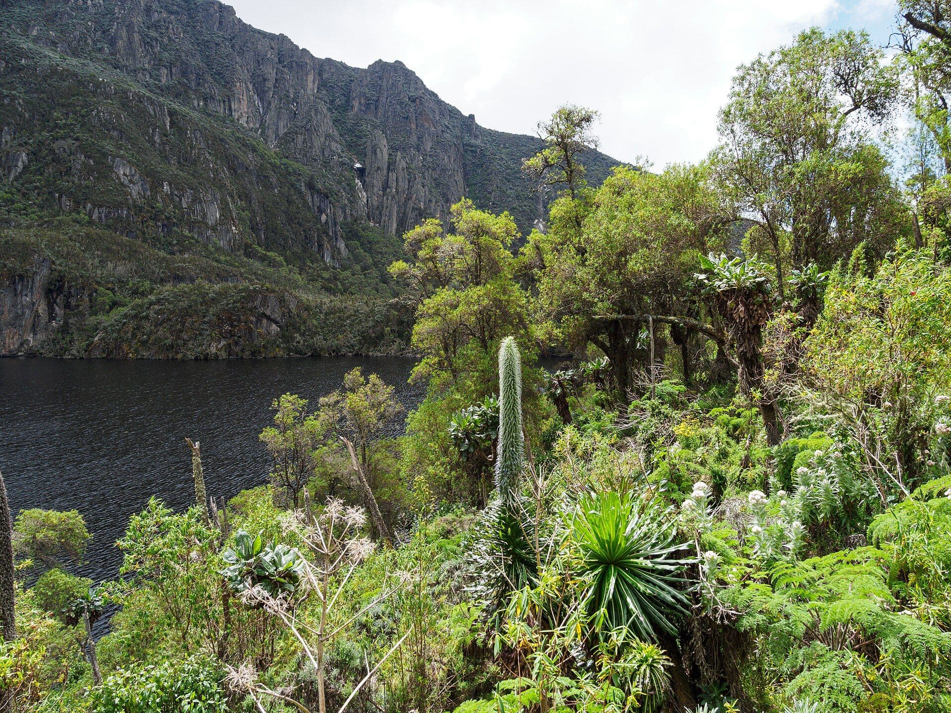
Giant lobelia above a Rwenzori lake. Dave: 'We were in a semi-arid section marked by large lobelia and dwarf trees.' Photo: Rafał Kozubek, CC BY-SA 4.0, via Wikimedia Commons.
We dropped our gear and sat down on an outcropping over a 300 meter drop down across a valley, with the step lakes, Black and Green, joined by a waterfall. Beyond, above the moraine, rose the glaciers and the mighty Ruwenzori range. Beside us, the only warm-blooded creatures were the three hawks soaring the slopes. In the hour and a half of clear skies, the temperature dropped to minus 2 Celsius. Ralph and Jeff fixed dinner, and we spent an hour spinning yarns about the trip up. We all had headaches, mostly from trying to use the miserable kerosene stove in the cabin, we gave up on that, and we hit the sack around 8:30.
The sixth day of the trip, we were up at dawn and hiked up the Wusiwameso Peak, 4.462 meters, and spent four hours in perfectly clear weather, taking in the panorama. A thunderstorm was in progress on the Uganda side and we could see the lightning in the high clouds and hear the thunder, but the storm stayed in Uganda. It was hard to know that we were on the equator, watching glaciers and snow fields. Mt. Margarita, the third highest mountain in Africa, was clear, as was the magnificent Moebius.
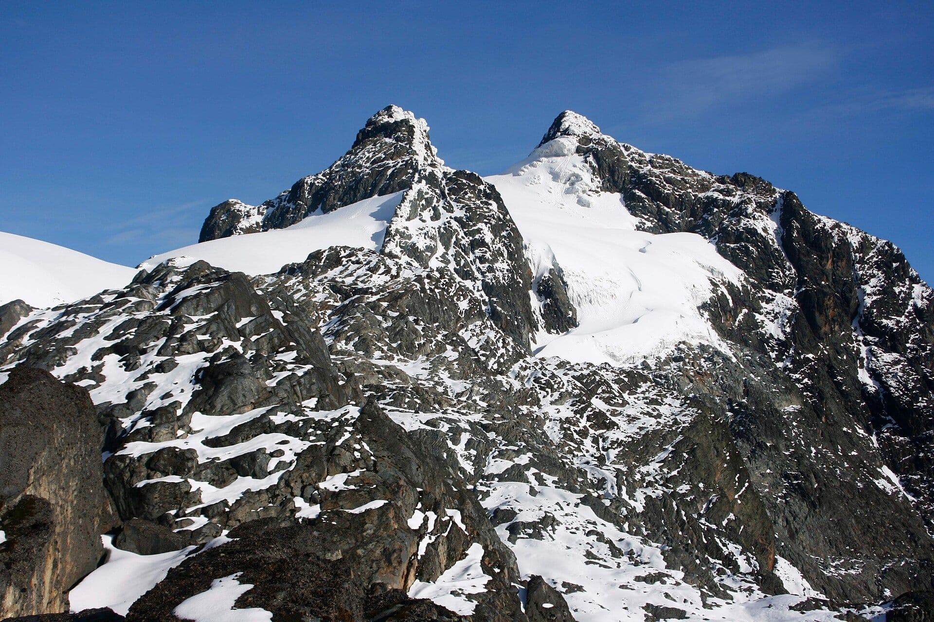
Mount Stanley, 2008. The ice has been shrinking since my dad saw it; the 2014 CNN piece he forwarded said it would be gone by 2030. Photo: Byekwaso Blasio, CC BY-SA 4.0, via Wikimedia Commons.
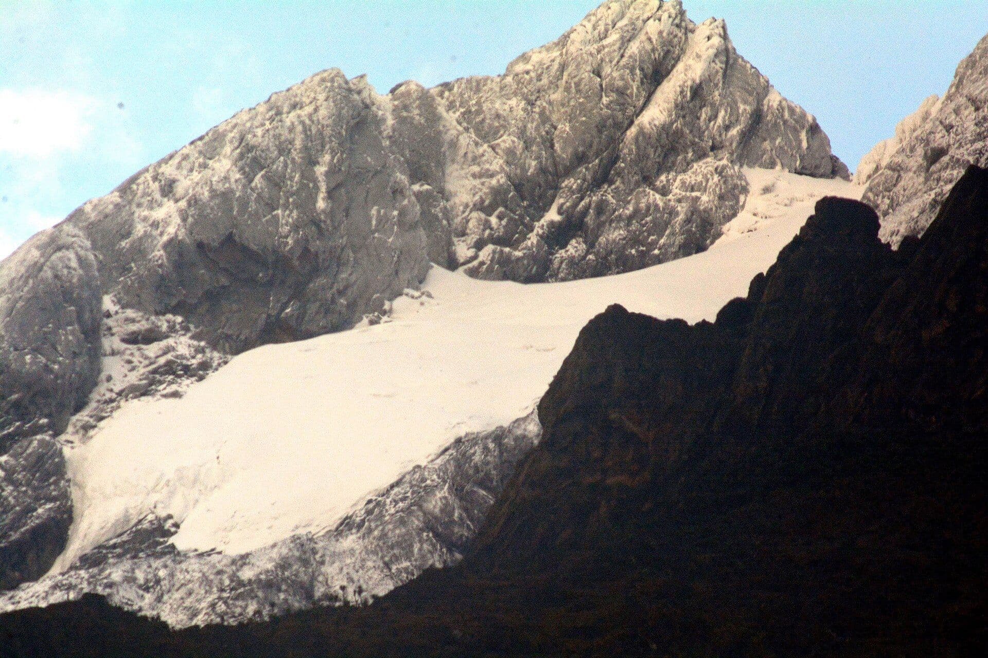
The Stanley Plateau snowfield. Glaciers on the equator. Photo: Vincent Mugaba, CC BY-SA 4.0, via Wikimedia Commons.
By noon, we began the descent, picking up out gear and porters at the Kiondo rest house. We returned to the Muhungo house and overnighted there. The seventh day, we hiked back to the Mutwanga/Mutsora base camp, arriving about noon. The last two hours, we hiked in the rain.
We drove to Butembo and stayed at a hotel built into the side of a foothill and enjoyed hot meals, cold beer and soft beds. On day eight, we arrived at noon at the Virunga game park lodge and took four game trails that day and the next morning. We saw antelope, lions, elephants, hippos, boar, cape buffalo, mongoose, baboon, chimpanzees and birds. We arrived at Goma about 2 pm on day eight. Marcel Dony of AMIZA had us on a plane to Kinshasa within two hours, after we went shopping for souvenirs and crates of famous Kivu vegetables. We arrived at Kinshasa’s airport that evening and Jeff and Ralph had arranged for one of Goodyear’s outrageous fula-fula buses to take us all home.
This trip, not easy to make, was a rare and fine experience. I have hiked in Glacier National Park, Canyonlands, northern Utah, the Himalayas of Nepal and Bali, and I think that the Ruwenzori trek was the best. Fred Lasor knows the East Africa game parks well, and regards the Virunga park as one of the best he has ever seen. The trip is worth the hassles one must put up with in Zaire. There are some things that we did not do, that could have been done, including skiing, extensive hiking in the range and climbing to the top of Margarita. For these activities, it is necessary to have a permit from the Direction Generale of the National Institute for the Conservation of Nature, located in Kinshasa. One can also obtain this permit at the INCVN station at Mutsora.
While we made this trip in eight days out of Kinshasa, one should plan on taking a minimum of ten days, to allow for logistics failures. While it is possible to make the ascension throughout the year, the best time is December-January and second-best time is July-August. Other times are very rainy. Ideal party size is six people. It is mandatory to have a guide. Porters are available at the base camp. In addition to the daily wage, it is necessary to provide the porters’ food (this can be purchased locally). A party of six hikers would have at least four porters and a guide. The total cost per person of this trip, from Kinshasa to the top and back, was about $800. Prices have probably gone up since our trip in January, 1978. The best thing for the feet would be a pair of Nike waffle-type running shoes, as attested by Ralph Cahalane. A sleeping bag, two sweaters, a rain-proof wind breaker, a stocking cap, heavy wool socks, hiking shorts and three changes of clothing are necessary. The three rest houses (“gites”) on the trail are ostensibly equipped with blankets, kitchen and eating utensils and kerosene stoves; however, don’t count on anything but a dry place with a roof over you head. Two beds from the last house were last seen on the backs of two Ugandans heading across the border.
Arrangements can best be made through the world-wide Agence Maritime, known as AMIZA in Zaire. It is essential to know a bit of French or Swahili. The address for the Ruwenzori headquarters is: Conservateur
B.P. 34
Beni, Nord Kivu, Republique du Zaire
Dave's account came with no pictures. I have asked my dad for his own photos from the trip. Until they turn up, the pictures on this page are other people's, from Wikimedia Commons, and each one says so.
Soundtrack, the night this went up: Stevie Nicks, "Changes." Then Simon and Garfunkel, "The Boxer."